Starting point

One more sensor does not solve the task.

Measurement data sits in separate systems. Between the measuring points, gaps remain in space and in time. And new technology has to fit processes, responsibilities and assets that have been in place for a long time. Another data portal or an expert report alone changes little about that.

We combine measurements on site with satellite, weather, gauge and specialist data, translate them into a situational picture and thereby create the basis for decisions that can be justified. Technical architecture, water-body processes, operation and financing are considered together from the outset.

Technology is the means. Knowledge is the goal.

Consulting fields

What we work on.

In most cases it is about measuring, drawing up a water balance, reporting or demonstrating an impact. Sometimes about something for which no product exists yet.

Monitoring and water quality

Which variables, at which location, at which interval, and how do the readings reach the place where decisions are made? We design measurement concepts for lakes, rivers, retention basins and engineered water systems, and we integrate sensors that are already in place.

Typical results

  • Measurement concept
  • Station and sensor design
  • Data architecture
  • Pilot installation
  • Operation and maintenance concept

Focus area: water quality

Water balance and low water

How much water is available, how is that changing, where do risks arise? We combine gauge and water-level data with precipitation, evaporation, catchment and satellite observation. What counts is the interplay within the catchment, not the individual measuring point.

Typical results

  • Water balance
  • Analysis of monitoring gaps
  • Low-water indicators
  • Scenarios
  • Regional situational picture

Focus area: flooding and low water

Communication and alert workflows

Alerting channels have to hold precisely when power or mobile networks fail. We plan energy-self-sufficient and redundant sensor and communication networks for retention basins, water bodies and municipal infrastructure, with resilience hubs that pool data locally and keep it available during a disruption. The decision to issue a warning remains with the responsible authority.

Typical results

  • Failure analysis
  • Network and communication architecture
  • Site planning
  • Redundancy concept
  • Pilot network

Focus area: communication

Connecting data

The value of data arises from connecting it. We bring our own readings together with official and specialist sources: the monitoring networks of the German federal states, LAWA, WasserBLIcK, BfG and DWD. Added to these are EFAS and Copernicus, SWOT (NASA/CNES), EnMAP (DLR), HydroATLAS and HydroSHEDS. From them we build maps, time series and automated analyses. Existing specialist systems are complemented, not replaced.

Typical results

  • Interface concept
  • Data consolidation
  • Automated reports
  • Map application
  • Analysis models

Monitoring & MRV

Planning measures and demonstrating impact

A measure does not become effective merely because it has been implemented. We build baselines, monitoring designs and analyses for renaturation, floodplain development, aeration, nutrient reduction and macrophyte management. This makes visible what has changed, how durable it is and where adjustments are needed.

Typical results

  • Initial state and baseline
  • Impact model
  • Monitoring plan
  • Before-and-after comparison
  • WFD assessment
  • MRV concept

Focus area: water-body restoration

Innovation projects and new systems

Where no product exists for the task, we develop one. We translate technical and operational needs into system requirements, examine the technical options, build partner structures and test under real conditions. The starting point is always the specific task.

Typical results

  • Target vision
  • Feasibility study
  • System design
  • Requirements list
  • Prototype
  • Field test

Current projects

Approach

From the task to a system that runs.

  1. Clarify the task and the decision at stake

    Which decision is to be taken better in future? We look at the water body, the data already available, the parties involved and the dependencies. What stands at the end is an objective, not a collection of technology.

  2. Design the solution and the architecture

    Water-body processes, measured variables, sensors, power supply, communication, data sources and analysis are brought together into one overall concept. Existing systems and investments already made remain part of it.

  3. Run a pilot and learn in operation

    The approach runs in a defined area. Operation under normal, load and fault conditions shows early on what holds and what has to be sharpened.

  4. Assess impact, secure operation

    Key figures, data quality, availability. Alongside them maintenance, responsibilities and restart procedures, so that a successful trial becomes permanent operation.

  5. Scale and transfer

    Proven building blocks move on to further water bodies, municipalities and regions. For that, standards, a rollout plan, a cost model and, where appropriate, a funding strategy are developed.

Research and funding

Funding logic is part of the solution.

Innovative water solutions rarely emerge from a single actor. They require knowledge of water bodies, research, technology, implementation partners and public users. e.Ray brings these sides together and translates between them, from partner structure, roles and work packages through milestones and funding logic to technical integration and the transfer into operation.

As a development partner

We build what we design.

Thought through from the water body

We begin with the system and with the decision that is due.

Vendor-neutral

Our own systems, existing sensors, partner products and public data sources are combined into one architecture.

Proven in live operation

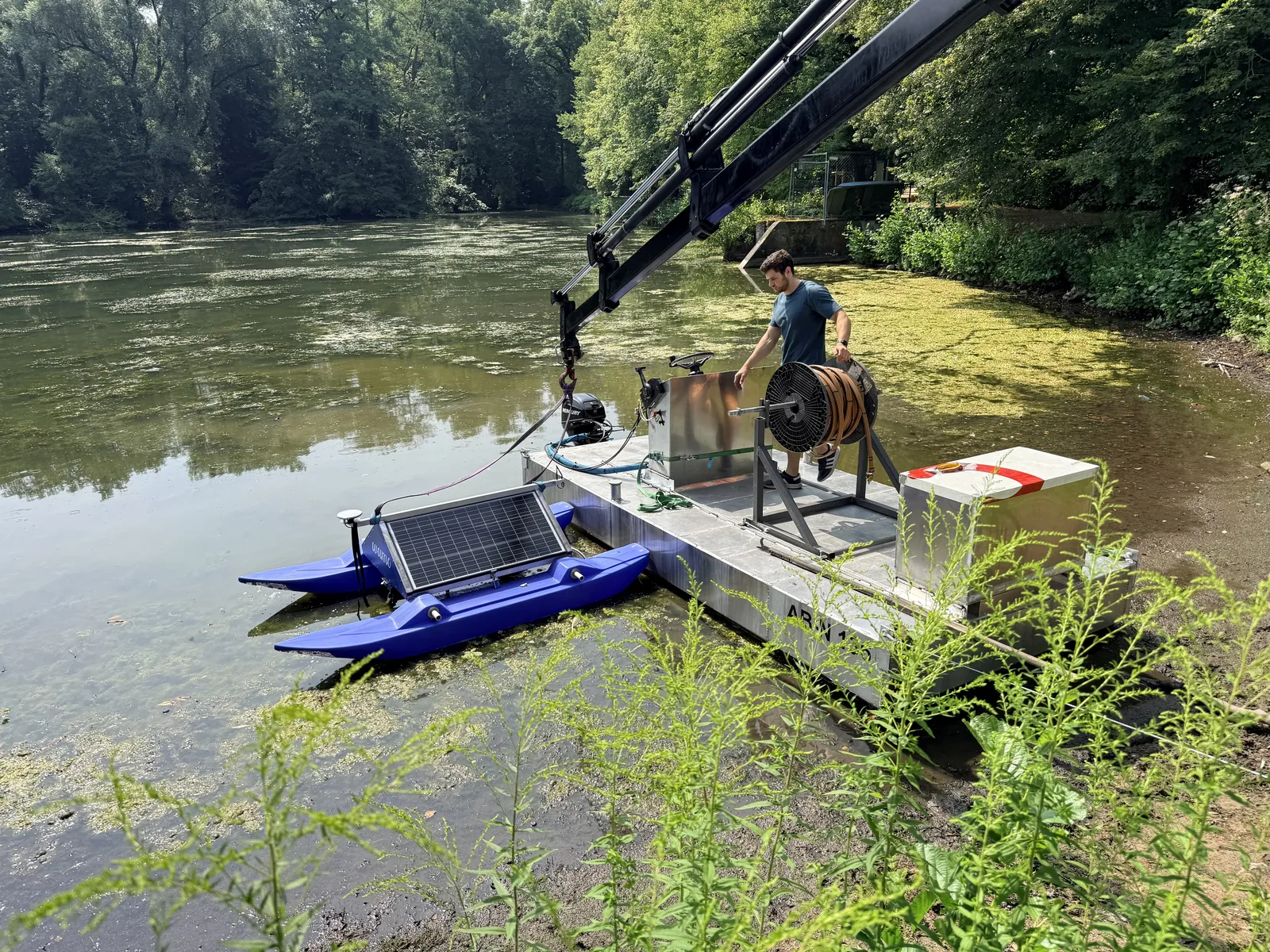
We develop, install and operate ourselves: 21 stations built in Mecklenburg-Vorpommern and handed over to regular operation, plus the WAMO Active pilot at the Backhausteich.

Energy-self-sufficient and redundant

Power, communication and data paths are planned so that they hold at remote sites and where infrastructure is limited.

From the measuring point to the catchment

Local real-time data, spatial data, remote sensing and models in one picture, from the individual site to the regional water balance.

Services

Can be commissioned individually.

The modules can be bundled into one project or awarded individually, for example as a preliminary study ahead of a tender.

Consulting modules

  • Strategy workshop and needs analysis
  • Feasibility study and target vision
  • Measurement, data and system concept
  • Site and network planning
  • Communication and redundancy concept
  • Energy-self-sufficient power supply
  • Requirements list and specification of services
  • Pilot planning, installation and field test
  • Failure and restart planning
  • Cost-benefit and scaling model
  • Funding strategy and consortium building
  • Impact monitoring, reports and decision papers

Who we work for

  • Cities, municipalities, districts and federal states
  • Water associations, water-body maintenance bodies and dam operators
  • Environmental, water and civil protection authorities
  • Water utilities and operators of water-related infrastructure
  • Consultants and consulting engineering firms
  • Research institutions and universities
  • Post-mining landscapes and land developers
Next step

Bring us your task.