
100 % self-sufficient
Two solar modules and a battery on board, with the status of modules and battery retrievable at any time. No power connection, no cabling, no permit procedure.
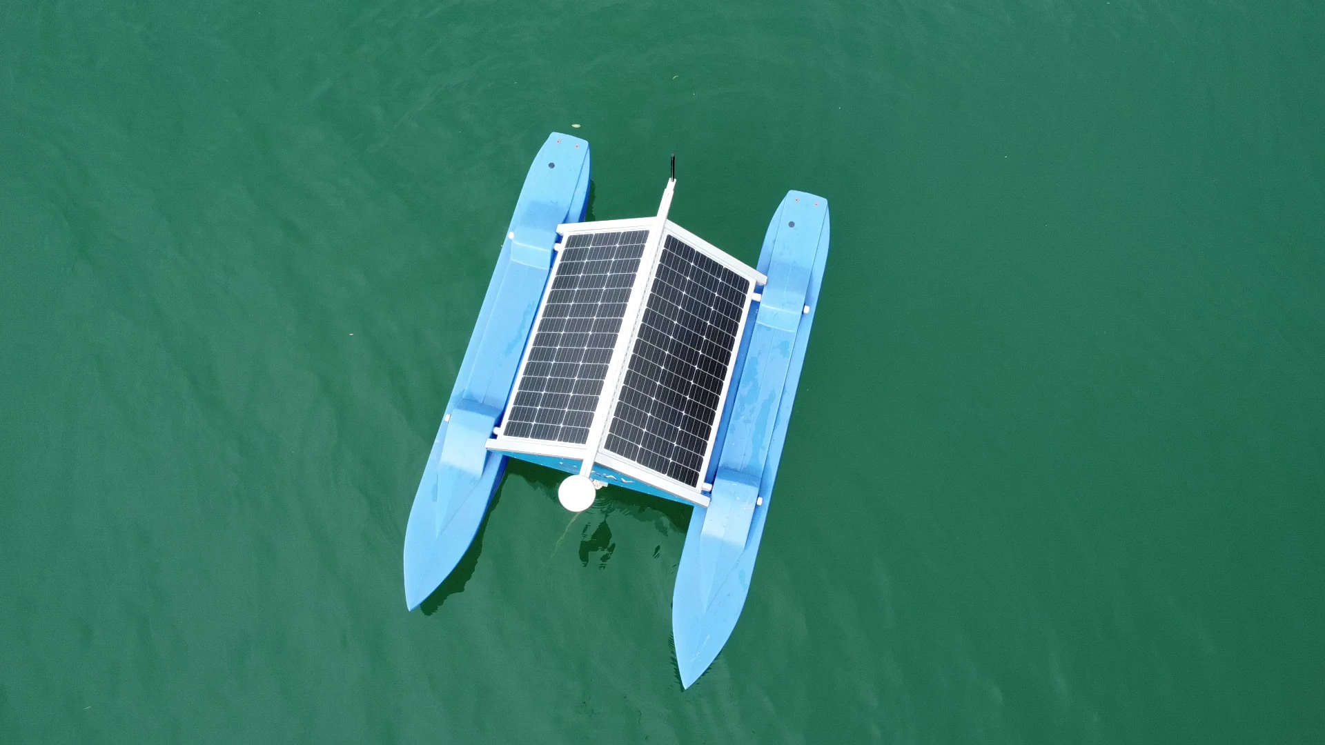
WAMO 220 brings professional water measurement even to sites that are difficult to access. The compact platform runs on solar power, requires no fixed power connection and transmits the measurement data directly for evaluation.
WAMO 220 is the compact measurement station for lakes, rivers and reservoirs: anchored where the readings are needed, it delivers data from day one – without a power connection and without civil-engineering works. Its largest deployment is running in the Mecklenburg lake district, where 20 stations measure continuously.
Two solar modules and a battery on board, with the status of modules and battery retrievable at any time. No power connection, no cabling, no permit procedure.
Hourly measurement cycles, data straight to SWIM. The first signs of an algal bloom are detected in hours – not weeks, as with grab samples.
Floats on top – measures even during floods, where stationary gauges have long since failed. No measurement-height limit. Vandal-resistant by design.
The station communicates directly with the mobile device or the evaluation system, via Wi-Fi or GSM/LTE. Probes connect to the on-board bus via Modbus and SDI-12, and an 8 GB data logger keeps the measurement series available.
Water-level derivation from Galileo and GPS distances – accurate to up to 2 cm, without pressure sensor or shore gauge. Pythagoras does the rest. Live demo on the WAMO overview.
Probe strings at multiple water depths capture thermal stratification and oxygen profiles – decisive for early eutrophication warning.
Multi-parameter sensing across four domains – water quality, hydrology, weather, bio-optics. Click a sensor to open the detail text.

The probe string hangs centrally between the pontoons beneath the station and measures where the water body is alive – not at the surface. The probe sits in a protected mount, remains accessible from above for maintenance and calibration, and can be extended to cover several water depths.


Excerpt from the current data sheet. Full spec table and configuration options on request.
| Build | Two side pontoons, flat solar roof, central probe string · 2.3 × 1.5 × 0.9 m · 90 kg |
|---|---|
| Solar / battery | 2× PV solar module 110 Wp (220 Wp total), 3.8–24 V DC · 50 Ah battery · status of the modules (temperature, voltage, current) and of the battery retrievable |
| Probe compatibility | Vendor-neutral – e.g. spectro::lyser or oxi::lyser by s::can, measurement probes from Endress+Hauser · expandable, e.g. vertical probe lift for multiple water depths · automated sensor cleaning |
| Standard parameters | Temperature · oxygen · turbidity · colour · TOC · DOC · BOD · COD · nitrate (NO₃-N) · UV254 · chlorophyll-a · spectral fingerprints · water level via GNSS · further parameters depending on probe configuration |
| Communication | Wi-Fi · GSM/LTE · Modbus and SDI-12 (on-board bus) · 8 GB data logger |
| Gauge accuracy | up to ±2 cm via GNSS distance calculation (Galileo + GPS, RTK baseline to base station) |
| Measurement cycle | Hourly by default · configurable from 5 min to 24 h |
| Data interface | SWIM (default) · API export (REST/JSON) · GIS layer (GeoJSON, Shapefile, CSV) |
In the Smart City model project “meer.zukunft.seen”, WAMO 220 runs in 20 lakes across the Mecklenburg lake district and the Vorpommern-Greifswald district – from Tollensesee to Reitbahnsee. Each station continuously delivers water-quality and water-level data to the municipal control rooms.
One family, two tasks. WAMO 220: compact station for surface waters. WAMO 600: vertical profiler for dam reservoirs, deep lakes and drinking-water reservoirs, to 100 m, with automatic sampling.

4Pommern · UsedomTV · April 2025
Television report on the first two stations in the Vorpommern-Greifswald district: Kosenowsee near Gützkow and Zarrenthiner Kiessee near Jarmen, with voices from the district and the project team.
Also on television ARD Nordmagazin: Badeseen: Überwachung der Wasserqualität mit neuer Sensorik ↗ 17 April 2025
We analyse your site, propose the right probe configuration and deliver a pilot station for one season – including SWIM connection.


